by Regina Sutton
The Internet is one of the best innovations ever invented by human. Though like every man-made things, it also has its downside. However, its usefulness outweighs its disadvantages. One of its numerous advantages is the ability to located items and navigates around the world using the satellite. Ever since the inception of positioning systems, capable electronic devices can find out their position and human can familiarize with unknown places around the world. GPS is the most popular positioning system, but it is not necessarily the best. I bet most of my reader does not know there are other positioning systems. Aside from private positioning and tracking systems operated by the military, communication, and government agencies, there are other public positioning systems. One of the best available open-source positioning systems is GLONASS; 'Globalnaya Navigazionnaya Sputnikovaya Sistema' which translates to 'Global Navigation Satellite System' in English. GLONASS is created and maintained by Russia. It is the Russian version of GPS. This article aims to give you access to all the information about GLONASS, its usefulness, and how you can implement it.
Contents
GLONASS provides real-time positioning and accurate velocity determination for both civilian and military use. It is the most suitable in high altitudes and can serve as an alternative to GPS in such locations. GLONASS is powered by 24 satellites located within circular orbit; 11,900 miles from the earth surface. 18 out of the 24 satellites are configured to cover the Russian territory while 6 are tasked to cover the remaining part of the world. Collectively, GLONASS has global coverage. As of 2010 till date, GLONASS is the most expensive projects run by Russian Federal Space Agency. The Russian Government spent over 5 billion dollars on the GLONASS project in 2011, and about 10 billion dollars from 2012 till date.
Few decades after World War II, many great nations invested in technology that will help them keep a close-eye on other countries. Furthermore, governments have to guard their territory with whatever means necessary, thus positioning and tracking system was invented. This gave birth to the likes of GLONASS and GPS. The Soviet Union initiated GLONASS in 1976, and in 1978 the first satellite was launched into space. Ever since its creation, GLONASS has been updated to many versions. The versions have experienced upgrades to keep up with today's requirements. Only the earliest version is out of service.
The aspects of GLONASS that have seen upgrades are clock error and signals, and to see how significant these upgrades are, you need to know their meanings.
Clock error
Clock error occurs when the satellite oscillator system is not fast enough to synchronize with other systems relying on its data. Or when there is a delay in transmitting the data. This reduces the accuracy in timing and positioning, and even a nano-second delay can affect the accuracy of positioning systems. Clock errors are of 3 types; transmission speed, satellite speed, and the working frequency.
a) The transmission speed is often referred to as the speed of light. It should be understandable because satellites use light waves to transmit signals to receptors down on earth. So, if components responsible for transmitting and receiving the signals should have issues, delay in transmissions will occur. And accuracy in the data transmitted will reduce.
b) Speed of satellites is self-explanatory, i.e., the speed at which satellites travel in space. This can highly influence accuracy as the satellites have to be in a particular location to accurately gather and transmit the data pertaining to such area. The satellites have been configured to obtain and transfer data at the pre-set interval. It won't matter whether the satellite is traveling fast enough to be in the perfect location before transmitting the data.
c) The working frequency has to do with the internal clocking system of satellites, i.e., how fast the satellites process data and send it out. A slower clocking system will result in delayed transmission.
Signals
GLONASS utilize two types of signals, which are FDMA and CDMA. FDMA signal is further divided into open standard-precision signal (L1OF/L2OF) and obfuscated high-precision signal (L1SF/L2SF). Also, GLONASS transmit two open CDMA signals and three restricted CDMA signals. You can find more information about all GLONASS signals on this Wikipedia page; https://en.wikipedia.org/wiki/GLONASS.
Below are the versions GLONASS in the order they were launched
#1 GLONASS
· Launched in 1982
· Currently out of service due to compatibility
· Clock error is 5×10⁻¹³
· FDMA signals; L1OF, L1SF, and L2SF
· No CDMA signal implemented
#2 GLONASS-M
· Launched in 2003
· Currently in service
· Clock error is 1×10⁻¹³
· FDMA signals are L1OF, L1SF, L2OF, and L2SF
· CDMA signal is L3OC
#3 GLONASS-K1
· Launched in 2011
· Currently in service
· Clock error ranges from 5×10⁻¹⁴ to 1×10⁻¹³
· FDMA signals are L1OF, L1SF, L2OF, and L2SF
· CDMA signal is L3OC
#4 GLONASS-K2
· Launched in 2023
· Currently in testing mode, i.e., not usable by the general public
· Clock error will range from 5×10⁻¹⁵ to 5×10⁻¹⁴
· FDMA signals are L1OF, L1SF, L2OF, and L2SF
· CDMA signals are L1OC, L1SC, L2OC, L2SC, and L3OC
#5 GLONASS-V
· Scheduled to launch between the year 2023 - 2025
· Currently in the design phase
· Clock error not yet determined
· FDMA signals not yet determined
· Will feature L1OC, L1SC, L2OC, L2SC, and L3OC CDMA signals
#6 GLONASS-KМ
· Scheduled to launch in 2030
· Currently in the research phase
· Clock error not yet determined
· FDMA signals are L1OF, L1SF, L2OF, and L2SF
· Will feature L1OC, L1SC, L2OC, L2SC, L3OC, L1OCM, L30CM and L50CM CDMA signals
While all these may seem technical for a non-technical person, the simpler version of GLONASS that less-technical person can interact with is the Assisted GLONASS (A-GLONASS). A-GLONASS collaborate with cell towers to provide tracking and positioning services. The services provided are navigational information, real-time object tracking, real-time traffic data, and so on. A-GLONASS also provide support to maximize performance in chips that support it.
Below are the complete tabulated differences and few similarities between GLONASS and GPS
| Specification/Characteristics | GLONASS | GPS |
| Full meaning | Global Navigation Satellite System | Global Positioning System |
| Ownership | Russian Federation | United States of America |
| Coverage | Global | Global |
| Number of satellites | 24 | 31 |
| Signal types | FDMA/CDMA | CDMA |
| Accuracy | 2.8 to 7.8 meters | 3.5 to 7.8 meters |
| Height | 21150 Km | 19130 km |
| Frequency | 1.246 GHz to 1.602 GHz | 1.2276 GHz to 1.57542 GHz |
It was stated earlier in this article that though GPS is the most popular positioning system, it is not the best in every aspect. GLONASS is better than GPS in term of commercial usage and accuracy. At its initial stage, GLONASS was first commercialized as car navigator, but it was expensive. So the Russian Government put more effort and in marketing it by subsidizing the price and reducing its bulkiness so that it can fit into smaller devices. Furthermore, GLONASS chips were developed, and this is how GLONASS came to mobile devices and smartphones. For maximum accuracy, GLONASS is being combined with GPS on smartphones; the first phone that features the combination is iPhone 4S.
As the license to use positioning systems is less stressful to obtain, more and more smartphone manufacturers are using the combination of GPS+GLONASS to deliver high-end location services to users. Whether you are buying a low-budget or expensive smartphone in 2023, it will always come with efficient location service courtesy of GPS and GLONASS. Aside from iPhone 4S, the list of other smartphones that make use of GLONASS either individually or combined with GPS is very long. But notable manufacturers that have been implementing it in their products are;
· Acer
· Alcatel
· Apple
· Asus
· Blackberry
· HTC
· Huawei
· LG
· Samsung
· Meizu
· Motorola
· Nokia
· OnePlus
· Sony Ericson
· Sony
· Xiaomi
· Techno
GLONASS provides two basic positioning services, which are SPS and PPS.
1. Standard Positioning System (SPS); also known as the Standard Accuracy Signal Service (SASS). This service is available for the general public. It is open-source thus free to use worldwide.
2. Precise Positioning System (PPS); also known as the High Accuracy Signal Service (HASS). This service is exclusive to military and licensed users. It is suitable where there is a need for high accuracy such as military drone strike, criminal tracking, earthquake, etc. The implementation price varies, and you can only get an actual price on the official website; http://en.roscosmos.ru.
How to implement GLONASS in your projects
Applying GLONASS in your projects require you having programming and hardware knowledge, and it is a job best left to experts in the said fields. However, if you have a keen interest in learning how to implement it, search engines like Google might be of great help.
Galileo is the European global satellite-based navigation system. Galileo provides improved timing and positioning for European-based users.
ü Galileo helps users know their exact position with greater accuracy.
ü Galileo is multiplatform and can be used by various devices such as cars, smartphones, tracking devices, and so on.
ü Many emergency services in Europe make use of Galileo because of its fast response feature.
ü Traffic on roads and railways in Europe is better because of Galileo traffic information.
ü Galileo boosts Europe's innovation; it creates more job IT companies are available to tap from its resources to develop innovative products.
Specific services offered by Galileo include;
ü Open Service (OS): with this service, you can use some features of Galileo for positioning and timing projects. GalileoOS is entirely free; open-source.
ü High Accurate Service (HAS): this service complements GalileoOS by providing more signal strength to boost accuracy. The High Accuracy Service signal is also encrypted to ensure more security for premium users.
ü Public Regulated Service (PRS): the service is exclusive to government-authorized users alone. The restriction is because of sensitive data being transacted via the channel and the need for super speed when processing.
ü Search and Rescue Service (SAR); Galileo contributes to COSPAS-SARSAT activities in Europe. COSPAS-SARSAT is an international search and rescue distress alert detection system that makes use of satellites.
China too joins the league of the countries that have a satellite positioning and tracking system. China developed its satellite system named BeiDou Navigation Satellite System, the system consists of 35 satellites, and it has global coverage.
The first and experimental BeiDou satellite was launched in the year 2000; it only covered China and its neighboring regions. It was later decommissioned in 2012. Other satellites have been launched before 2012 and the latest; BeiDou-3 was launched in June 2023.
BeiDou is being utilized in many applicable fields such satellite tracking system, search and rescue missions, emergency natural hazard detection, and so on. BeiDou is available for both military and commercial uses.
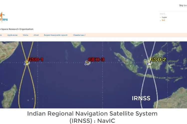
Indian Regional Navigation Satellite System, also known as NAVIC (NAVigation with Indian Constellation), is a satellite navigation system that provides real-time timing and positioning services in India and its neighboring regions. IRNSS has 7 satellites in orbit; there are plans for more satellites and broader coverage in the future.
The first IRNSS was launched in July 2013. IRNSS provides two primary services which are;
1. Standard Positioning Service (SPS); this service is available to the general public in India, and it is free. The accuracy for Standard Positioning Service is 10 meters.
2. Restricted Service (RS); available to authorized users, e.g., licensed security companies, Chinese military, etc. Data transmitted using this service are highly encrypted. Accuracy for IRNSS Restricted is one of the best in the world; 0.1 meter.
There are many other satellite positioning systems we did not have a chance to discuss. However, these satellite systems are the most popular. The information provided here are accurate, and you can confirm from individual official sites. GLONASS has resources not yet explored, and the best first step is to create awareness about it. Now that you know about GLONASS, hope you will let your friends know about it too.

About Regina Sutton
Regina's blogging journey began several years ago when she started a personal blog as a creative outlet. Her unique perspective, combined with her ability to engage readers through her words, quickly gained attention and a loyal following. As her blog gained popularity, Regina expanded her content to cover various topics, including travel, lifestyle, fashion, and self-improvement.
 |
 |
 |
 |
Check These Out
Come here for FREE Gifts. We want to share some nice tips and great tricks. First, disable your adblocker for them
Once done, hit anything below
|
|
|
|
 BostonCommons